Pawtuckaway State Park Redlining
Submitted by Pat
Stats
Date: May 27, 2025
Weather: Mostly sunny, high 70s
Mileage: 9.66
Elevation Gain: 419
Trails: Oak Trail, Fundy Trail, Shaw Trail, Split Rock Trail, Woronoco Trail
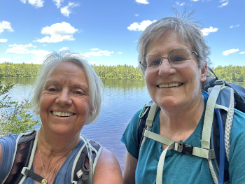
 Nancy and I agree to trace the trails in Pawtuckaway State Park located near Nottingham, NH for another patch. We meet at the Long Branch Restaurant in Raymond, NH for breakfast. It’s an old, musty-smelling diner with only locals in attendance. Nancy and I haven’t seen each other for a couple of weeks and a few inches of silence has grown between us. We talk a little hesitantly but soon warm to each other’s presence and discuss our plan for the day. It’s a bluebird sky with temperatures in the 70s and an occasional breeze.
After breakfast, we caravan to the boat launch on Fundy Road. We gear up, put on bug spray, and immediately choose the wrong trail. We turn around and walk to the other side of the parking area and head up the Oak Trail, a 2.4 mile out-and-back trail bordering Fundy Cove. It’s quiet. The boats passing by are either using electric motors or moving silently across the water of Pawtuckaway Lake under a low-wake engine. We realize as we hike that we need our low gaiters and poles for the next section of trail.
Back at the car, we put on gaiters, grab our poles and start out down the 1.7-mile Fundy Trail. The bird song I hear is wonderful, music to my ears. We hear a scarlet tanager and a black and white warbler. The trail is well-marked though we encounter a lot of standing water, muddy pools that we tramp around the edges when possible.
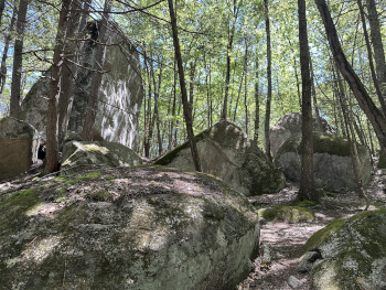
The Fundy Trail leads us to what we call the Rock Garden. It is a huge area filled with erratics, large house-sized boulders dropped in this area by glaciers millions of years ago. There is also a volcanic ring dike that is smaller than the one in the Ossipee Range. The park’s mountains, including North, Middle and South Mountains, follow the circular pattern of this ring dike. We are enthralled by the boulders, and while the trail is undulating, the footing is good. I look up occasionally and see my surroundings. Usually my eyes are aimed downward when I hike.
 We turn left onto the Shaw Trail, deep in the woods, far from the presence of other people, enjoying the breeze and each other’s company. We talk about my hurt when she responded to my email about hiking Pawtuckaway with three words. She hears me and when she speaks, I listen and hear her continued unwillingness to hope for a strong, regular hiking companion. She’s been disappointed enough by my occasional though predictable inability to hike on any given day, be it a medical issue or an appointment getting in the way.
By the time we turn left onto the Split Rock Trail, my shins clench and my hips ache, though it’s nothing I can’t walk through. We talk openly about books, her sister, our friendship, and the miles roll by under our booted feet. We turn left again on the Woronoco Trail as we make our way back toward the parking lot.
We hike beside Burnham’s Marsh which is a stagnant breeding ground for mosquitoes. Mosquitoes dog us for the rest of the hike. The trail becomes a road when we turn left onto the Fundy Trail. I am dragging ass by then but remain stalwart and keep pace with Nancy who is used to high mileage. We finally reach the parking lot around 2:30 pm.
 It feels great to take my boots off and put on sandals. The cold drinks Nancy brings for us taste fantastic. We were going to soak our feet in the lake, but there is no place to get in that isn’t yucky to stand in.
As we prepare to leave, we find no cell service, and we can’t get our map apps to find a satellite. Because we were able to find our way in, I assumed we would have the technology to get ourselves home. We exit the parking area and head down Fundy Road with our map apps desperately searching for a satellite. We reach an intersection where we must turn right or left. Nancy votes for right so right it is.
Unfortunately, nothing looks familiar. Nancy finally receives a signal and is on her way. I turn around and head back toward town, guessing that I should turn right at some intersection I vaguely remember. Finally, the app finds a satellite and I’m on my way home, a thoroughly exercised and happy hiker.