Mt. Success
Submitted by Pat
Stats
Mountain: Mt. Success (3,565)
Date: September 23, 2017
Miles: 2.7 redline miles, 6 total miles
Elevation Gain: 2,162
Trail: Success Trail


 I am feeling a lack of confidence due to my usual poor fitness level and Nancy wants to tack more mileage onto the 6-mile hike to see the wreckage of the plane that crashed near the summit of Mt. Success:
Early on Nov. 30, 1954, a Douglas DC 3 designated Flight 656 left New York for Boston and Laconia, where it continued north towards Berlin as Flight 792. The weather worsened as it approached the Berlin Airport, located in the outlying town of Milan. The pilot approached the airport on instruments. But a combination of factors, including a possible instrument failure that gave him the impression that he was already above the airport, plus extreme rough air, caused him to fly much lower than the glide path and the plane crashed into the east side of Mount Success. It broke apart and came to rest 200 vertical feet below the summit. The cockpit section hit first and shattered. It broke from the main cabin. The tail came to rest further down the mountain. All seven people aboard survived the crash, but two in the cockpit died of their injuries that night. Despite his severe injuries, the pilot William Carey survived. In the cabin, the three passengers and flight attendant survived without injuries. Soon after the crash, the crew sent out a weak message, initiating a search. A search plane spotted survivors on the summit of Mount Success. All were lifted out by helicopter. ~ Ed Parsons, Conway Daily Sun
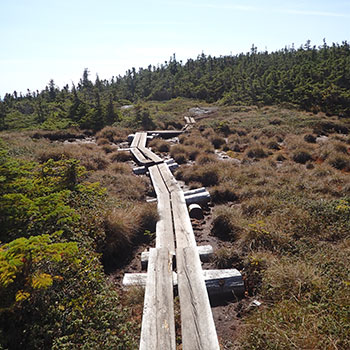
The climb proves easy enough for me to handle without experiencing fatigue or discomfort. Located in the Mahoosuc Range, Mt. Surprise is a hidden gem. We come out on top of a ridge to find an open alpine meadow crossed by bog bridges. We eat a little on the summit then keep on hiking for about ten minutes before turning left down a herd path in order to find the wreckage. We come to an intersection of a couple of herd paths with one trail parallel to the AT that is blazed in yellow. 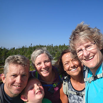 Unfortunately, our trail beta doesn’t indicate which way to turn at this point so, discouraged, we return to the summit of Mt. Success to eat our lunch.
A family of three whom we had seen at the outlook earlier arrive at the summit and Nancy begins talking with the dad. They have a little more information about the location of the wreckage – their beta describes a yellow blazed boundary marker as the right spot. We decide to join them in the search for the wreck. Maybe together we can find it. We lead them to the herd path and then to the intersection of the yellow blazed boundary trail and for some reason that feels right, we turn left down the boundary trail. The well-trod herd path soon becomes a bushwhack as I lead us deeper and deeper into the woods – following the yellow blazes. We actually hike .7 of a mile before I lose the blazes and we decide to turn back.
The family – Mom (Dawn), Dad (Mark or Bob) and young son (Brendan) are troopers and hang in there with us the whole way. I doubt we would have hiked so far without the positive energy each party brought to the other. We are definitely motivated as we slide down moss-covered ledges and grapple up the other side. My legs get pretty scratched and I’m proud to be leading us. Turning back unsatisfied after we worked so hard to get that far is a disappointment.
We finally return to the intersection of the herd path and I decide to go a little farther had we turned right instead of left. It’s a well-trodden path but when I arrive at a point where the trail descends, I hesitate and Nancy calls me back. [If I had walked another 20 feet, I would have seen the wreckage.]