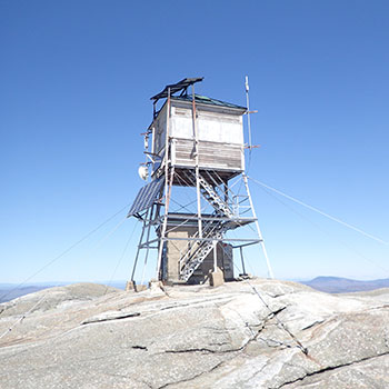
Mt. Cardigan Fire Tower
Submitted by Pat
Stats
Mountain: Mt. Cardigan (3,155)
Date: May 11, 2018
Time: 7 hours
Weather: Sunny, windy
Miles: 8
Trail: Holt Trail — Clark-Holt Cutoff — Clark Trail — Mowglis Trail — West Ridge Trail — Skyland Trail — Vistamont Trail


 Nancy and I meet at the Rt. 104 Diner in New Hampton for breakfast and then drive to the Cardigan Lodge to start our hike. We head up the Holt Trail at 8:30 am and then take a left at the Holt-Clark Cutoff and hike to the Clark Trail. We want to avoid the stress of climbing the class 3 ledges on the final approach to the summit on the Holt Trail. Looking at the ledges on a web site, they look kind of like the North Tripyramid slide but smoother – hands and feet climbing. Turns out we do plenty of that just hiking up the Clark Trail!
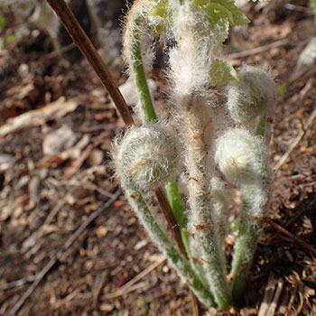
The Holt Trail must be used as a ski trail in the winter as it’s wide and steep. It feels good for me to be occasionally in the lead, like old times. Here and there we stop to take pictures – of fiddleheads with their newborn down unfurling from the earth, a few hobble bushes in bloom, a trillium or two.
Once on the Clark Trail, the path narrows, surrounding us with evergreens as we leave the deciduous trees behind. Shortly thereafter, we begin walking on rock slabs, some quite large and steep but neither of us slip all day despite our concern. The trail is perfect.
The final, above tree line walk to the fire tower is bitterly cold because of a brisk wind. I guess it’s a sustained 25-30 mph wind. Nancy is pretty cold so we quickly find the blazes to get over to Firescrew via the Mowglis Trail. When we get out of the wind, sheltering near some low shrub pines, we have a snack. It’s a clear, bluebird day, hardly anyone on the trail. All told we see six people.
 As we sit and talk about how steep the Manning Trail looks, I suggest maybe we go back to Cardigan and head over to Mt. Gilman (Mt. Orange) and go down from there. It looks to be a mile longer than we have planned and we decide to give it a try, I because I want to hike on new trails and Nancy because she wants more exercise.
The climb back up Mt. Cardigan’s slabs is tough on already tired legs, but the wind and cold don’t bother me much and I stay in short sleeves. We stop next to the tower and check the map. From the summit we take the West Ridge Trail down the slabs until we reach a junction that says east to AMC. Not knowing what the sign is referring to, we take out Nancy’s phone and check her GPS app to make sure we’ve chosen the correct trail. It is. We eventually reach an unmarked peak called Rim Rock and begin a ridge walk on the Skyland Trail toward Mt. Gilman. The map we have doesn’t show any of the trail names we’re encountering at the different junctions, so navigating is a challenge. We spend the time figuring out our direction and only continue on when both of us are happy with our decision.
The ridge trail is beautiful – evergreens of all shapes, lots of moss, and bare rock glittering with sparklies. The sky is a robin’s egg blue. Our hearts are full of joy. We reach Mt. Gilman and after our navigation conversation we head down on the Vistamont Trail. There comes a point in the trail when the line between evergreens and deciduous trees is so precise it’s amazing! An hour later, we reach the Holt-Clark Cutoff, follow that until we reach the Holt Trail and back to the car.
We arrive at the parking lot at 3:30 pm and enjoy using the facilities at the Cardigan Lodge to change our clothes and use the restroom. What a fantastic 8 mile day!